DBAR Makes its Debut in Africa
From 24 to 28 October, 2016, an eight-member delegation of the Digital Belt and Road (DBAR) Program was invited to attend the 11th International Conference of the African Association of Remote Sensing of the Environment (AARSE 2016), held in Kampala, Uganda. The major objective of the participation was to establish a formal partnership between DBAR and the African Association of Remote Sensing of the Environment (AARSE), and to promote international cooperation with the Silk Road Economic Belt and the 21st Century Maritime Silk Road (abbreviated as the "Belt and Road") Initiative between DBAR and Africa, particularly North and East African countries and regions.
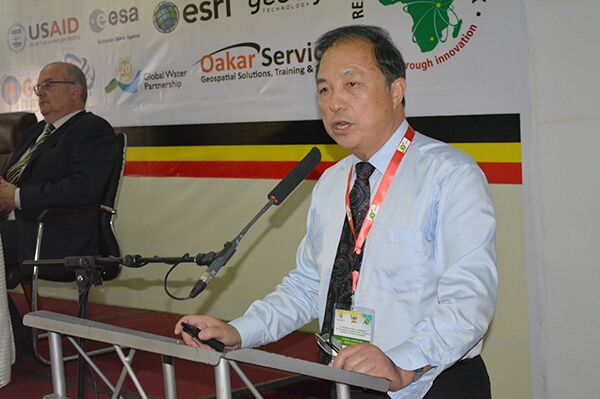
At the opening ceremony on the morning of the 24th of October, Prof. GUO Huadong gave a keynote presentation titled, "China's Earth Observation Progress and DBAR". After giving an introduction to the development of Earth observation in China, he elaborated on the concept, vision, objectives, and framework of scientific research and cooperation of DBAR, and pointed out that DBAR is based on multi-source, massive data from space-based, air-based, and ground-based systems using simulation techniques to understand the Belt and Road. It is a huge information system including aggregation and representation of data and information related to Earth and space. DBAR is a digital, virtual system which can remodel complex geological processes and socioeconomic phenomena to support decision making. The goal of DBAR is to promote the construction of Earth observation systems and data sharing, implement regional and global scientific cooperation, and understand the key issues of the environment and development along the Belt and Road quickly and accurately through cross-border, stereoscopic, synergistic Earth observation. DBAR mainly focuses on coastal zone resources, disaster risk reduction, agriculture and food security, environmental change monitoring, water and urban areas, and world heritage conservation—six areas in which to carry out cooperative research and to establish links with other existing global Earth observation platforms to produce data, information, expertise and knowledge. He also introduced the Earth observation technology and applications that DBAR can implement in Africa, and finally proposed formal cooperation between DBAR and Africa.
In the afternoon, DBAR organized a special session titled "DBAR and AARSE: new horizons for cooperation between Africa and China". The session was co-chaired by Prof. JIA Li and three other scientists from Africa. Prof. JIA Li, Prof. CHEN Fang, Prof. Massimo MENENTI and Prof. WANG Changlin gave scientific presentations respectively on "Introduction to Research and Exchange Programs of China and Opportunities for Cooperation with Africa", "DBAR for Scientific Capacities for Sustainable Development in Africa", "Driving Mechanisms of Land Use and Cover Change in the Sahel: Impacts and Responses (DIMECLUS)", and "ISDE & HIST: Two International Platforms for Promoting Collaboration towards DBAR". After the scientific presentations, Prof. GUO Huadong, Prof. JIA Li and Prof. WANG Changlin participated in a panel discussion on prospects for expanded cooperation as panelists from China. They explored "big Earth observation data" for sustainable development in Africa, and discussed capacity building modes and research focuses in the context of DBAR-AARSE cooperation. All participants of AARSE 2016 attended the special session. DBAR was the only focus of the first day of AARSE 2016, which will have a significant impact in Africa.
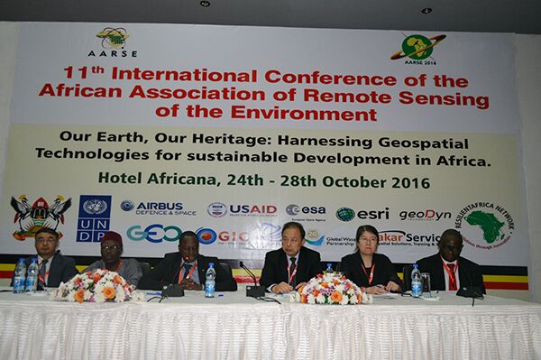
Special Session "DBAR and AARSE: new horizons for cooperation between Africa and China".
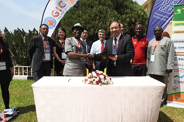
Prof. GUO Huadong and Prof. Olajide Kufoniyi sign an MoU.